
Routes your scooter may ride
Every route keeps to the fietspad, fiets/bromfietspad or rijbaan your class may use, and stays off the autoweg and autosnelweg. Up to three routes to choose from.
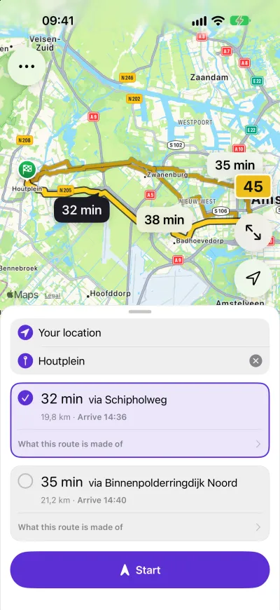
Car navigation sends a scooter onto roads it is banned from. Cycling navigation sends it up paths it may not use. Broemwijs plans for the plate you actually ride.
For iPhone · Netherlands only
In the Netherlands the plate decides where you may ride and how fast. Tell the app once, and every route and every limit follows from it.
bromfiets · up to 45 km/h
| Where | What applies |
|---|---|
| The rijbaan | 45 km/h, where there is no fiets/bromfietspad |
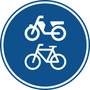 Fiets/bromfietspadG12A | You must use it. 30 km/h in town, 40 km/h outside |
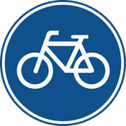 FietspadG11 | Not allowed. You ride the rijbaan |
 Onverplicht fietspadG13 | Never |
snorfiets · up to 25 km/h
| Where | What applies |
|---|---|
| The rijbaan | 25 km/h, where there is no cycle path |
| Fiets/bromfietspadG12A | You must use it. 25 km/h |
| FietspadG11 | You must use it. 25 km/h |
| Onverplicht fietspadG13 | Only with the engine off |
Some municipalities send a snorfiets onto the rijbaan in certain streets. Those local rules are not in the app yet, so watch for the signs.
Every route keeps to the fietspad, fiets/bromfietspad or rijbaan your class may use, and stays off the autoweg and autosnelweg. Up to three routes to choose from.
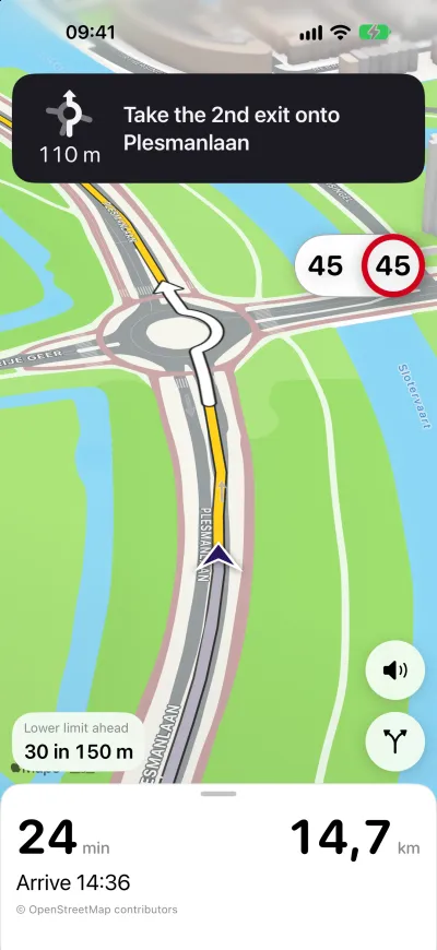
Spoken instructions in Dutch and English. Large cards you read at a glance from a handlebar mount. Mute with one press.
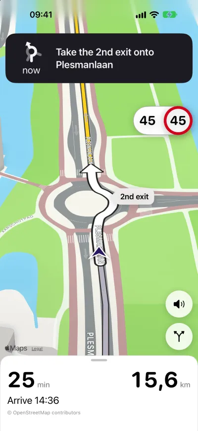
The limit for your class on the road you are on sits beside your speed for the whole ride. A lower limit ahead is shown before you get there.
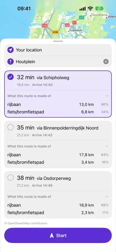
The same trip on a blue plate takes the cycle paths a snorfiets must use. Switch plates and the routes change with it.
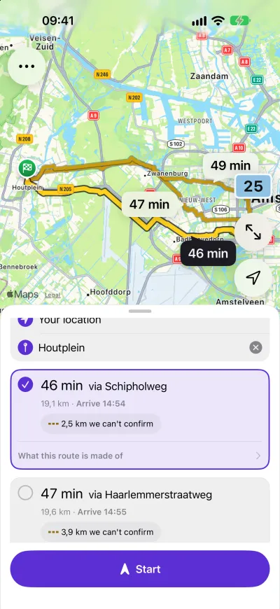
Each route shows what it is made of: how much is rijbaan and how much is cycle path. Where the map cannot confirm a stretch, the route says so instead of guessing.
Ride history, saved places and recent destinations are kept on your phone. There is no account, and there is nothing to sign in to.
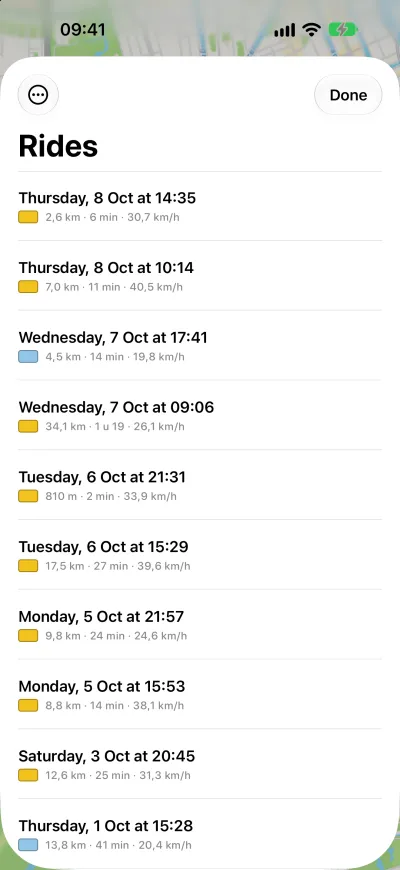
Your rides, the places you save, the routes you plan and the paths the app learns from your riding are kept on your phone. They are never uploaded, and there is no account. Planning a route downloads map data for the area you route through; it does not send who you are or where you have been.
These are the things the app cannot see. The same list is in the app, under Menu › About. Where the app and a sign disagree, the sign is right.
The roads and paths come from OpenStreetMap, which people maintain by hand. It can be wrong or missing something, and what is on your phone can be up to 30 days old.
Some paths get their rules from a sign at the entrance rather than from the map. Most of the time the app does not have that sign, and falls back to the map. Read the signs where a path begins.
Where the map does not say whether your plate may use a path, the route card marks that part instead of hiding it. The mark means we don’t know, not we checked. Decide from the signs.
Inside the bebouwde kom the limit is often lower than outside it. The app has no complete list of where those areas start and end, so treat the limit it shows as the most you might be allowed.
A number of municipalities require a snorfiets to ride on the rijbaan instead of the cycle path. None of those areas are in the app yet. Watch for the local signs.
Everything the app tells you is about one plate. It assumes a snorfiets until you choose otherwise, so check your plate before you set off.
Map data © OpenStreetMap contributors, available under the Open Database License.
Which scooters is Broemwijs for? A bromfiets (yellow plate, up to 45 km/h) and a snorfiets (blue plate, up to 25 km/h). You choose your plate in the app, and you can change it at any time.
Where does it work? In the Netherlands only. A trip that starts or ends outside the Netherlands is not planned.
Do I need an account? No. There is no Broemwijs account. Your rides, places and settings stay on your phone.
Does it work without an internet connection? You need a connection to plan a route. The map for a planned route is kept on your phone for the ride.
Which iPhones are supported? Any iPhone that runs iOS 26 or later. There is no Android version.
Which languages does it speak? The app and its spoken instructions are in Dutch and English.